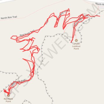
Canyon Lookout Point - Red Rock Point - Yellowstone River
Yellowstone National Park
- Distance: 1.0 mi
- Elevation gain: 394 ft
- Maximum elevation: 7,740 ft
- Elevation loss: 394 ft
- Minimum elevation: 7,428 ft
- Moving time: 25 m 26 s
- Moving speed: 2.4 mph
- Maximum speed: 15.5 mph
- Total time: 31 m 12 s
- Global speed: 1.9 mph
Interactive trail map
Trail profile
- Distance: 1.0 mi
- Elevation gain: 394 ft
- Maximum elevation: 7,740 ft
- Elevation loss: 394 ft
- Minimum elevation: 7,428 ft
- Moving time: 25 m 26 s
- Moving speed: 2.4 mph
- Maximum speed: 15.5 mph
- Total time: 31 m 12 s
- Global speed: 1.9 mph
About this trail
Name: Canyon Lookout Point - Red Rock Point - Yellowstone River trail, distance, elevation, map, profile, GPS track
Start: Lookout Point Trail, Park County, Wyoming, United States (44.72129 -110.48790)
End: Lookout Point Trail, Park County, Wyoming, United States (44.72124 -110.48832)
Coordinates: 44.71985 -110.49036 44.72143 -110.48790
Topography: Park County topographic map, elevation, terrain