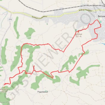
Track0000
- Distance: 15.1 mi
- Elevation gain: 1,936 ft
- Maximum elevation: 968 ft
- Elevation loss: 1,942 ft
- Minimum elevation: 390 ft
Interactive trail map
Trail profile
- Distance: 15.1 mi
- Elevation gain: 1,936 ft
- Maximum elevation: 968 ft
- Elevation loss: 1,942 ft
- Minimum elevation: 390 ft
About this trail
Name: Track0000 trail, distance, elevation, map, profile, GPS track
Coordinates: 44.28871 20.98497 44.33017 21.07096
Other hiking, mountain biking, running and outdoor activity trails
Click on a trail to view its statistics, map and profile.
2022_Yu
Slovenia > Ajdovščina > Žapuže
Distance: 1,526.9 mi • Elevation gain: 105,144 ft • Maximum elevation: 6,398 ft