Bedford Peak
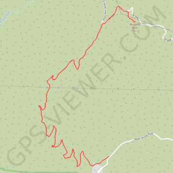
Interactive trail map
Trail profile
- Distance: 3.6 mi
- Elevation gain: 2,054 ft
- Maximum elevation: 3,750 ft
- Elevation loss: 197 ft
- Minimum elevation: 1,877 ft
About this trail
Name: Bedford Peak trail, distance, elevation, map, profile, GPS track
Start: Silverado Motorway, Orange County, California, United States (33.74920 -117.58203)
End: North Main Divide Road, Riverside County, California, United States (33.76687 -117.57799)
Coordinates: 33.74784 -117.59319 33.76895 -117.57799
Topography: Orange County topographic map, elevation, terrain