
Baskett Slough NWR loop trail via Rich Guadagno Observation Platform
- Distance: 1.5 mi
- Elevation gain: 223 ft
- Maximum elevation: 446 ft
- Elevation loss: 223 ft
- Minimum elevation: 249 ft
- Moving time: 35 m 14 s
- Moving speed: 2.6 mph
- Maximum speed: 4.0 mph
- Total time: 43 m 18 s
- Global speed: 2.1 mph
Interactive trail map
Trail profile
- Distance: 1.5 mi
- Elevation gain: 223 ft
- Maximum elevation: 446 ft
- Elevation loss: 223 ft
- Minimum elevation: 249 ft
- Moving time: 35 m 14 s
- Moving speed: 2.6 mph
- Maximum speed: 4.0 mph
- Total time: 43 m 18 s
- Global speed: 2.1 mph
About this trail
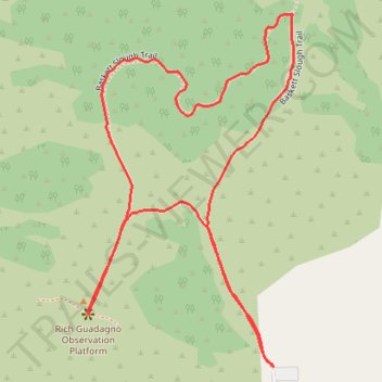
Name: Baskett Slough NWR loop trail via Rich Guadagno Observation Platform trail, distance, elevation, map, profile, GPS track
Coordinates: 44.96207 -123.26168 44.96785 -123.25690
Topography: Polk County topographic map, elevation, terrain