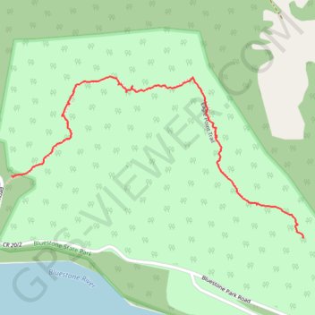
Eagle Point Trail in Bluestone State Park
- Distance: 1.0 mi
- Elevation gain: 525 ft
- Maximum elevation: 2,057 ft
- Elevation loss: 154 ft
- Minimum elevation: 1,572 ft
- Moving time: 32 m 26 s
- Moving speed: 1.9 mph
- Maximum speed: 4.5 mph
- Total time: 59 m 2 s
- Global speed: 1.0 mph
Interactive trail map
Trail profile
- Distance: 1.0 mi
- Elevation gain: 525 ft
- Maximum elevation: 2,057 ft
- Elevation loss: 154 ft
- Minimum elevation: 1,572 ft
- Moving time: 32 m 26 s
- Moving speed: 1.9 mph
- Maximum speed: 4.5 mph
- Total time: 59 m 2 s
- Global speed: 1.0 mph
About this trail
Name: Eagle Point Trail in Bluestone State Park trail, distance, elevation, map, profile, GPS track
Start: Eagle Point Trail, Summers County, West Virginia, 25978, United States (37.61801 -80.92904)
End: Eagle Point Trail, Summers County, West Virginia, 25978, United States (37.61629 -80.91893)
Coordinates: 37.61629 -80.92904 37.62075 -80.91892
Topography: Summers County topographic map, elevation, terrain
Other hiking, mountain biking, running and outdoor activity trails
Click on a trail to view its statistics, map and profile.
New River Gorge
United States > West Virginia > Mercer County > Athens
Distance: 128.2 mi • Elevation gain: 17,510 ft • Maximum elevation: 2,792 ft