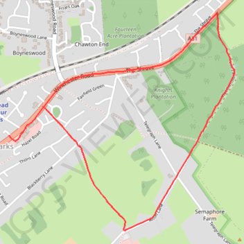
Four Marks Weathermore Lane
- Distance: 2.3 mi
- Elevation gain: 118 ft
- Maximum elevation: 705 ft
- Elevation loss: 148 ft
- Minimum elevation: 633 ft
- Moving time: 21 m 16 s
- Moving speed: 6.6 mph
- Maximum speed: 8.0 mph
- Total time: 21 m 16 s
- Global speed: 6.6 mph
Interactive trail map
Trail profile
- Distance: 2.3 mi
- Elevation gain: 118 ft
- Maximum elevation: 705 ft
- Elevation loss: 148 ft
- Minimum elevation: 633 ft
- Moving time: 21 m 16 s
- Moving speed: 6.6 mph
- Maximum speed: 8.0 mph
- Total time: 21 m 16 s
- Global speed: 6.6 mph
About this trail
Name: Four Marks Weathermore Lane trail, distance, elevation, map, profile, GPS track
Coordinates: 51.10683 -1.04456 51.11753 -1.02691