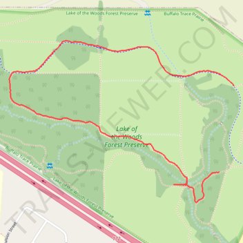
Lake of the Woods Forest Preserve
- Distance: 1.5 mi
- Elevation gain: 66 ft
- Maximum elevation: 755 ft
- Elevation loss: 66 ft
- Minimum elevation: 692 ft
- Moving time: 53 m 5 s
- Moving speed: 1.7 mph
- Maximum speed: 2.9 mph
- Total time: 1 h 5 m
- Global speed: 1.4 mph
Interactive trail map
Trail profile
- Distance: 1.5 mi
- Elevation gain: 66 ft
- Maximum elevation: 755 ft
- Elevation loss: 66 ft
- Minimum elevation: 692 ft
- Moving time: 53 m 5 s
- Moving speed: 1.7 mph
- Maximum speed: 2.9 mph
- Total time: 1 h 5 m
- Global speed: 1.4 mph
About this trail
Name: Lake of the Woods Forest Preserve trail, distance, elevation, map, profile, GPS track
Coordinates: 40.20216 -88.40761 40.20813 -88.39675
Topography: Champaign County topographic map, elevation, terrain