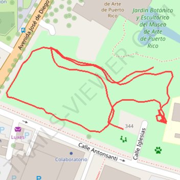
Parque Santurce footpath
- Distance: 0.6 mi
- Elevation gain: 43 ft
- Maximum elevation: 79 ft
- Elevation loss: 36 ft
- Minimum elevation: 52 ft
- Moving time: 13 m 21 s
- Moving speed: 2.5 mph
- Maximum speed: 4.7 mph
- Total time: 41 m 26 s
- Global speed: 0.8 mph
Interactive trail map
Trail profile
About this trail
Name: Parque Santurce footpath trail, distance, elevation, map, profile, GPS track
Coordinates: 18.44698 -66.06732 18.44785 -66.06552
Topography: San Juan topographic map, elevation, terrain