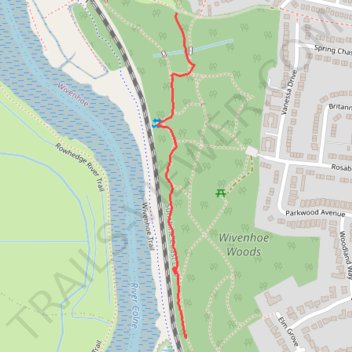
Thank you for supporting this site ❤️
Make a donation
Make a donation
Gear up for your next adventure:
As an Amazon Associate, this site earns from qualifying purchases at no extra cost to you.
Wivenhoe Woods
- Distance: 0.5 mi
- Elevation gain: 26 ft
- Maximum elevation: 59 ft
- Elevation loss: 46 ft
- Minimum elevation: 30 ft
- Moving time: 10 m 55 s
- Moving speed: 2.5 mph
- Maximum speed: 3.7 mph
- Total time: 11 m 36 s
- Global speed: 2.4 mph
Interactive trail map
Thank you for supporting this site ❤️
Make a donation
Make a donation
Gear up for your next adventure:
As an Amazon Associate, this site earns from qualifying purchases at no extra cost to you.
Trail profile
- Distance: 0.5 mi
- Elevation gain: 26 ft
- Maximum elevation: 59 ft
- Elevation loss: 46 ft
- Minimum elevation: 30 ft
- Moving time: 10 m 55 s
- Moving speed: 2.5 mph
- Maximum speed: 3.7 mph
- Total time: 11 m 36 s
- Global speed: 2.4 mph
Thank you for supporting this site ❤️
Make a donation
Make a donation
Gear up for your next adventure:
As an Amazon Associate, this site earns from qualifying purchases at no extra cost to you.
About this trail
Name: Wivenhoe Woods trail, distance, elevation, map, profile, GPS track
Coordinates: 51.85966 0.95199 51.86515 0.95299
Thank you for supporting this site ❤️
Make a donation
Make a donation
Gear up for your next adventure:
As an Amazon Associate, this site earns from qualifying purchases at no extra cost to you.