Thank you for supporting this site ❤️
Make a donation
Make a donation
Gear up for your next adventure:
As an Amazon Associate, this site earns from qualifying purchases at no extra cost to you.
Mount Stapylton West
- Distance: 3.7 mi
- Elevation gain: 476 ft
- Maximum elevation: 1,033 ft
- Elevation loss: 269 ft
- Minimum elevation: 804 ft
- Moving time: 1 h 56 m
- Moving speed: 1.9 mph
- Maximum speed: 3.8 mph
- Total time: 3 h 35 m
- Global speed: 1.0 mph
Interactive trail map
Thank you for supporting this site ❤️
Make a donation
Make a donation
Gear up for your next adventure:
As an Amazon Associate, this site earns from qualifying purchases at no extra cost to you.
Trail profile
- Distance: 3.7 mi
- Elevation gain: 476 ft
- Maximum elevation: 1,033 ft
- Elevation loss: 269 ft
- Minimum elevation: 804 ft
- Moving time: 1 h 56 m
- Moving speed: 1.9 mph
- Maximum speed: 3.8 mph
- Total time: 3 h 35 m
- Global speed: 1.0 mph
Thank you for supporting this site ❤️
Make a donation
Make a donation
Gear up for your next adventure:
As an Amazon Associate, this site earns from qualifying purchases at no extra cost to you.
About this trail
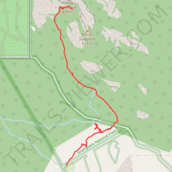
Name: Mount Stapylton West trail, distance, elevation, map, profile, GPS track
Coordinates: -36.92304 142.37968 -36.89398 142.39416
Thank you for supporting this site ❤️
Make a donation
Make a donation
Gear up for your next adventure:
As an Amazon Associate, this site earns from qualifying purchases at no extra cost to you.