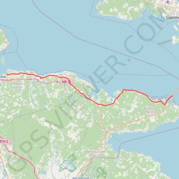
Shédiac - Borden-Carleton
Gulf of Saint Lawrence. #Bike #Shédiac #BordenCarleton #SaintLawrence #Atlantic
- Distance: 41.1 mi
- Elevation gain: 965 ft
- Maximum elevation: 157 ft
- Elevation loss: 974 ft
- Minimum elevation: -3 ft
Interactive trail map
Trail profile
- Distance: 41.1 mi
- Elevation gain: 965 ft
- Maximum elevation: 157 ft
- Elevation loss: 974 ft
- Minimum elevation: -3 ft
About this trail
Name: Shédiac - Borden-Carleton trail, distance, elevation, map, profile, GPS track
Coordinates: 46.13164 -64.52300 46.22912 -63.81446
Other hiking, mountain biking, running and outdoor activity trails
Click on a trail to view its statistics, map and profile.