Braich dinas to craig cwm silyn to obelisk and above knife edge, down above slate mineu
Early section along stream is fun, possibly stay higher to limit exposure. To waterfall would make good walk for kids.
Some evidence of path, especially above gorge, but mostly make your own way.
One wall to climb, but fairly easy , stay on left-hand side above stream until footbridge and gate
Beyond gate I headed straight uphill towards Summit, not on path, and a bit relentless till viewpoint, then quad bike path to near summit with good views to snowdon.
Google Maps satellite suggests better to follow track to right out of gate , which joins quad bike track lower down, and avoid unforgiving stretch, possibly also with better views, albeit longer.
Where rocks begin near Summit Found path that limits need to scramble over rocks but unavoidable in last stretch.
Beyond summit clear paths, with some semi scrambling, excellent views
Worth going to third summit for view
Descent mostly easy with some bum sliding.
Lost path a bit above slate mine, possibly better to descend through mine.
Last stretch down from Tramway had a lot of young cows, possibly best to avoid this if concerned.
Four hours of almost continuous, quite rapid walking, so this is probably a day walk.
Parking is possible on Meadow by stream, voluntary payment to Farm, need coins.
- Distance: 7.0 mi
- Elevation gain: 2,884 ft
- Maximum elevation: 2,392 ft
- Elevation loss: 2,884 ft
- Minimum elevation: 417 ft
- Moving time: 3 h 23 m
- Moving speed: 2.1 mph
- Maximum speed: 4.5 mph
- Total time: 3 h 56 m
- Global speed: 1.8 mph
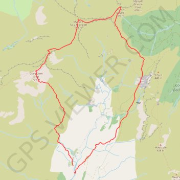
Interactive trail map
Trail profile
- Distance: 7.0 mi
- Elevation gain: 2,884 ft
- Maximum elevation: 2,392 ft
- Elevation loss: 2,884 ft
- Minimum elevation: 417 ft
- Moving time: 3 h 23 m
- Moving speed: 2.1 mph
- Maximum speed: 4.5 mph
- Total time: 3 h 56 m
- Global speed: 1.8 mph
About this trail
Name: Braich dinas to craig cwm silyn to obelisk and above knife edge, down above slate mineu trail, distance, elevation, map, profile, GPS track
Start: Dolbenmaen, Gwynedd, Wales, LL51 9AX, United Kingdom (53.01019 -4.18778)
End: Dolbenmaen, Gwynedd, Wales, LL51 9AX, United Kingdom (53.00888 -4.18731)
Coordinates: 53.00866 -4.20026 53.04219 -4.16392
Other hiking, mountain biking, running and outdoor activity trails
Click on a trail to view its statistics, map and profile.
Ultra-Trail Snowdonia Eryri UTS 100M
United Kingdom > Wales > Gwynedd > Llanberis
Distance: 101.4 mi • Elevation gain: 31,837 ft • Maximum elevation: 3,471 ft