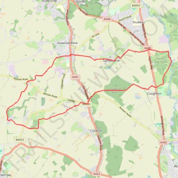
Spernall Woods 🔁 Morton Hall
- Distance: 11.6 mi
- Elevation gain: 725 ft
- Maximum elevation: 469 ft
- Elevation loss: 725 ft
- Minimum elevation: 167 ft
- Moving time: 1 h 53 m
- Moving speed: 6.1 mph
- Maximum speed: 9.6 mph
- Total time: 1 h 57 m
- Global speed: 5.9 mph
Interactive trail map
Trail profile
- Distance: 11.6 mi
- Elevation gain: 725 ft
- Maximum elevation: 469 ft
- Elevation loss: 725 ft
- Minimum elevation: 167 ft
- Moving time: 1 h 53 m
- Moving speed: 6.1 mph
- Maximum speed: 9.6 mph
- Total time: 1 h 57 m
- Global speed: 5.9 mph
About this trail
Name: Spernall Woods 🔁 Morton Hall trail, distance, elevation, map, profile, GPS track
Coordinates: 52.22906 -1.97639 52.25880 -1.87535
Other hiking, mountain biking, running and outdoor activity trails
Click on a trail to view its statistics, map and profile.
Alcester trail run
United Kingdom > England > Warwickshire > Stratford-on-Avon > Alcester > Arrow > Oversley Green
Morning Run
Distance: 13.9 mi • Elevation gain: 909 ft • Maximum elevation: 407 ft