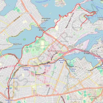
Taverners Hill - Balmain
Interactive trail map
Trail profile
- Distance: 6.4 mi
- Elevation gain: 597 ft
- Maximum elevation: 128 ft
- Elevation loss: 512 ft
- Minimum elevation: -3 ft
About this trail
Name: Taverners Hill - Balmain trail, distance, elevation, map, profile, GPS track
Coordinates: -33.88963 151.14441 -33.84814 151.19048
Other hiking, mountain biking, running and outdoor activity trails
Click on a trail to view its statistics, map and profile.
Sydney Loop Ride via Homebush Bay, Powells Creek, Hudson Park, Cooks River Cycleway, Cooks to Cove Greenway, Hawthorne Canal and Iron Cove
Australia > New South Wales > Sydney
Distance: 33.9 mi • Elevation gain: 1,125 ft • Maximum elevation: 112 ft
Sydney to Oran Park NSW
Australia > New South Wales > Sydney
Distance: 37.5 mi • Elevation gain: 1,893 ft • Maximum elevation: 413 ft