Bellthorpe - Stoney Creek
Bellthorpe National Park. #MTB #Loop #Bellthorpe
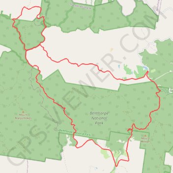
- Distance: 25.4 mi
- Elevation gain: 4,216 ft
- Maximum elevation: 2,178 ft
- Elevation loss: 4,219 ft
- Minimum elevation: 446 ft
Interactive trail map
Trail profile
- Distance: 25.4 mi
- Elevation gain: 4,216 ft
- Maximum elevation: 2,178 ft
- Elevation loss: 4,219 ft
- Minimum elevation: 446 ft
About this trail
Name: Bellthorpe - Stoney Creek trail, distance, elevation, map, profile, GPS track
Coordinates: -26.90044 152.65831 -26.81147 152.75065
Other hiking, mountain biking, running and outdoor activity trails
Click on a trail to view its statistics, map and profile.
Mount Kilcoy Loop
Bellthorpe National Park. Conondale National Park. #MTB #Loop #Bellthorpe #Conondale
Distance: 36.3 mi • Elevation gain: 4,879 ft • Maximum elevation: 2,352 ft