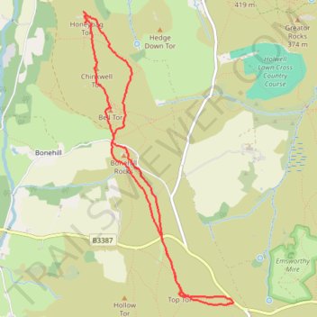
Top Tor, Bonehill Rocks, Bell Tor, Chinkwell Tor and Honeybag Tor Loop
- Distance: 4.3 mi
- Elevation gain: 692 ft
- Maximum elevation: 1,490 ft
- Elevation loss: 692 ft
- Minimum elevation: 1,171 ft
- Moving time: 1 h 56 m
- Moving speed: 2.2 mph
- Maximum speed: 4.0 mph
- Total time: 2 h 54 m
- Global speed: 1.5 mph
Interactive trail map
Trail profile
- Distance: 4.3 mi
- Elevation gain: 692 ft
- Maximum elevation: 1,490 ft
- Elevation loss: 692 ft
- Minimum elevation: 1,171 ft
- Moving time: 1 h 56 m
- Moving speed: 2.2 mph
- Maximum speed: 4.0 mph
- Total time: 2 h 54 m
- Global speed: 1.5 mph
About this trail
Name: Top Tor, Bonehill Rocks, Bell Tor, Chinkwell Tor and Honeybag Tor Loop trail, distance, elevation, map, profile, GPS track
Coordinates: 50.57131 -3.79799 50.59430 -3.77945