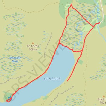
UK, Aberdeenshire, Loch Muick
Mountain Bike Ride
- Distance: 9.1 mi
- Elevation gain: 696 ft
- Maximum elevation: 1,398 ft
- Elevation loss: 696 ft
- Minimum elevation: 1,293 ft
Interactive trail map
Trail profile
- Distance: 9.1 mi
- Elevation gain: 696 ft
- Maximum elevation: 1,398 ft
- Elevation loss: 696 ft
- Minimum elevation: 1,293 ft
About this trail
Name: UK, Aberdeenshire, Loch Muick trail, distance, elevation, map, profile, GPS track
Coordinates: 56.92618 -3.19321 56.95890 -3.13583