Import a GPX file

Roche Miette Canyon

Jasper National Park. #Hiking #Jasper

  • Distance: 1.8 mi
  • Elevation gain: 551 ft
  • Maximum elevation: 3,812 ft
  • Elevation loss: 551 ft
  • Minimum elevation: 3,258 ft

Interactive trail map

Trail profile

  • Distance: 1.8 mi
  • Elevation gain: 551 ft
  • Maximum elevation: 3,812 ft
  • Elevation loss: 551 ft
  • Minimum elevation: 3,258 ft

About this trail

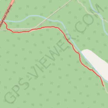
Name: Roche Miette Canyon trail, distance, elevation, map, profile, GPS track

Start: Roche Miete, Improvement District No. 12, Alberta, Canada (53.18519 -117.96542)

End: Roche Miete, Improvement District No. 12, Alberta, Canada (53.18519 -117.96542)

Coordinates: 53.17914 -117.96542 53.18519 -117.94976

Gear up for your next adventure:

🥾Hiking Shoes - Durable and comfortable shoes for trail hiking
🛶Inflatable Kayak - Portable kayak for rivers, lakes, and expeditions
🪶Compact Camp Shovel - Folding shovel for campsite tasks
🧤Hiking Gloves - Protective gloves for rugged trails
❄️Traction Cleats - Prevent slips on icy trails during winter hikes

As an Amazon Associate, this site earns from qualifying purchases at no extra cost to you.