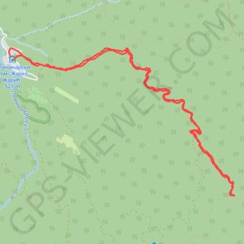
JASTREBAC, MEČJE STENE
- Distance: 6.4 mi
- Elevation gain: 1,998 ft
- Maximum elevation: 3,291 ft
- Elevation loss: 2,005 ft
- Minimum elevation: 1,696 ft
- Moving time: 2 h 29 m
- Moving speed: 2.6 mph
- Maximum speed: 6.0 mph
- Total time: 3 h 48 m
- Global speed: 1.7 mph
Interactive trail map
Trail profile
- Distance: 6.4 mi
- Elevation gain: 1,998 ft
- Maximum elevation: 3,291 ft
- Elevation loss: 2,005 ft
- Minimum elevation: 1,696 ft
- Moving time: 2 h 29 m
- Moving speed: 2.6 mph
- Maximum speed: 6.0 mph
- Total time: 3 h 48 m
- Global speed: 1.7 mph
About this trail
Name: JASTREBAC, MEČJE STENE trail, distance, elevation, map, profile, GPS track
Coordinates: 43.41151 21.37414 43.42867 21.41019
Other hiking, mountain biking, running and outdoor activity trails
Click on a trail to view its statistics, map and profile.
Jastrebac: Planinarski dom - Sokolov kamen - Bela stena - Ži...
Serbia > Central Serbia > Rasina Administrative District > Buci
Distance: 8.2 mi • Elevation gain: 2,854 ft • Maximum elevation: 4,058 ft
2022_Yu
Slovenia > Ajdovščina > Žapuže
Distance: 1,526.9 mi • Elevation gain: 105,144 ft • Maximum elevation: 6,398 ft