Import a GPX file

Salmon Pools (Sentier Trous de Saumon)

  • Distance: 6.2 mi
  • Elevation gain: 558 ft
  • Maximum elevation: 233 ft
  • Elevation loss: 584 ft
  • Minimum elevation: 49 ft
  • Moving time: 2 h 6 m
  • Moving speed: 2.9 mph
  • Maximum speed: 23.0 mph
  • Total time: 2 h 21 m
  • Global speed: 2.6 mph

Interactive trail map

Trail profile

  • Distance: 6.2 mi
  • Elevation gain: 558 ft
  • Maximum elevation: 233 ft
  • Elevation loss: 584 ft
  • Minimum elevation: 49 ft
  • Moving time: 2 h 6 m
  • Moving speed: 2.9 mph
  • Maximum speed: 23.0 mph
  • Total time: 2 h 21 m
  • Global speed: 2.6 mph

About this trail
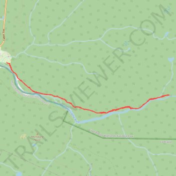
Name: Salmon Pools (Sentier Trous de Saumon) trail, distance, elevation, map, profile, GPS track

Start: Roberts Brook Road, Cape Breton Highlands National Park, Inverness County, Nova Scotia, Canada (46.64341 -60.94669)

End: 37639, Cabot Trail, Cape Breton Highlands National Park, Inverness County, Nova Scotia, Canada (46.64355 -60.94778)

Coordinates: 46.63208 -60.94778 46.64355 -60.89389

Gear up for your next adventure:

🧭GPS Watch Accessories - Bands and chargers for GPS watches
🎒Trekking Poles - Sturdy poles for balance and stability on rough terrain
🌡️Portable Weather Meter - Track weather conditions on the trail
🪶Fire Starter Kit - Reliable fire starter for survival and camping
🎒Trail Energy Bars - High‑calorie bars for hiking energy

As an Amazon Associate, this site earns from qualifying purchases at no extra cost to you.