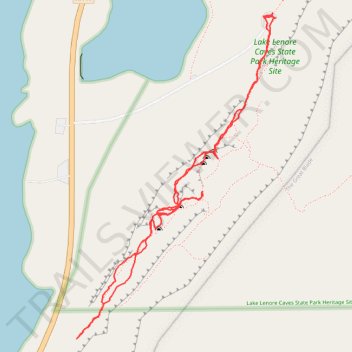
Lake Lenore Caves
- Distance: 2.0 mi
- Elevation gain: 505 ft
- Maximum elevation: 1,345 ft
- Elevation loss: 505 ft
- Minimum elevation: 1,145 ft
- Moving time: 1 h 3 m
- Moving speed: 1.9 mph
- Maximum speed: 3.6 mph
- Total time: 1 h 42 m
- Global speed: 1.2 mph
Interactive trail map
Trail profile
- Distance: 2.0 mi
- Elevation gain: 505 ft
- Maximum elevation: 1,345 ft
- Elevation loss: 505 ft
- Minimum elevation: 1,145 ft
- Moving time: 1 h 3 m
- Moving speed: 1.9 mph
- Maximum speed: 3.6 mph
- Total time: 1 h 42 m
- Global speed: 1.2 mph
About this trail
Name: Lake Lenore Caves trail, distance, elevation, map, profile, GPS track
Coordinates: 47.50900 -119.50124 47.51772 -119.49338
Topography: Grant County topographic map, elevation, terrain