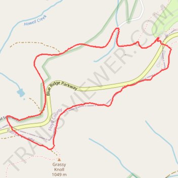
Black Ridge Trail in Rocky Knob Recreation Area
- Distance: 3.0 mi
- Elevation gain: 535 ft
- Maximum elevation: 3,458 ft
- Elevation loss: 535 ft
- Minimum elevation: 3,061 ft
- Moving time: 1 h 30 m
- Moving speed: 2.0 mph
- Maximum speed: 4.8 mph
- Total time: 1 h 41 m
- Global speed: 1.8 mph
Interactive trail map
Trail profile
- Distance: 3.0 mi
- Elevation gain: 535 ft
- Maximum elevation: 3,458 ft
- Elevation loss: 535 ft
- Minimum elevation: 3,061 ft
- Moving time: 1 h 30 m
- Moving speed: 2.0 mph
- Maximum speed: 4.8 mph
- Total time: 1 h 41 m
- Global speed: 1.8 mph
About this trail
Name: Black Ridge Trail in Rocky Knob Recreation Area trail, distance, elevation, map, profile, GPS track
Start: Blue Ridge Parkway, Floyd County, Virginia, United States (36.81133 -80.35055)
End: Blue Ridge Parkway, Floyd County, Virginia, United States (36.81136 -80.35055)
Coordinates: 36.80234 -80.36590 36.81212 -80.34932
Topography: Floyd County topographic map, elevation, terrain