Pulpit Rock, The Pinnacle and Hamburg Reservoir Loop via Appalachian Trail
The Pulpit Rock, Pinnacle, and Hamburg Reservoir Loop offers a rewarding hiking experience characterized by stunning vistas and diverse terrain. Along the trail, hikers can enjoy expansive views of the Lehigh Valley, rocky outcrops, and the serene beauty of the Hamburg Reservoir, making it a picturesque journey through Pennsylvania's natural landscape. The moderate to challenging elevation changes add an adventurous element, while the unique geological features and abundant wildlife sightings enhance the overall enjoyment of this scenic hike. #Hiking #Loop #Overlook #Forest #Nature
- Distance: 9.3 mi
- Elevation gain: 1,293 ft
- Maximum elevation: 1,608 ft
- Elevation loss: 1,270 ft
- Minimum elevation: 715 ft
- Moving time: 3 h 17 m
- Moving speed: 2.8 mph
- Maximum speed: 10.8 mph
- Total time: 3 h 43 m
- Global speed: 2.5 mph
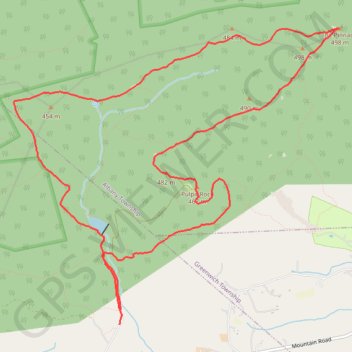
Interactive trail map
Trail profile
- Distance: 9.3 mi
- Elevation gain: 1,293 ft
- Maximum elevation: 1,608 ft
- Elevation loss: 1,270 ft
- Minimum elevation: 715 ft
- Moving time: 3 h 17 m
- Moving speed: 2.8 mph
- Maximum speed: 10.8 mph
- Total time: 3 h 43 m
- Global speed: 2.5 mph
About this trail
Name: Pulpit Rock, The Pinnacle and Hamburg Reservoir Loop via Appalachian Trail trail, distance, elevation, map, profile, GPS track
End: Reservoir Road, Windsor Township, Berks County, Pennsylvania, United States (40.58370 -75.94198)
Coordinates: 40.58214 -75.95686 40.61338 -75.91178
Topography: Windsor Township topographic map, elevation, terrain
Other hiking, mountain biking, running and outdoor activity trails
Click on a trail to view its statistics, map and profile.
Pulpit Rock, The Pinnacle and Hamburg Reservoir Loop
United States > Pennsylvania > Berks County > Windsor Township > Edenburg
This loop trail offers a memorable hike through Pennsylvania's scenic landscape. The trail provides sweeping views from the dramatic outcrops of Pulpit Rock and The Pinnacle, where hikers can enjoy vistas of the Lehigh Valley and nearby rolling hills. Along the way, the trail winds through varied terrain, from…
Distance: 9.2 mi • Elevation gain: 1,335 ft • Maximum elevation: 1,611 ft