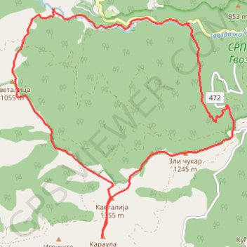
Studena planina,Stojanac,Zli Čukar, Kavgalija,Karaula
- Distance: 10.8 mi
- Elevation gain: 2,707 ft
- Maximum elevation: 4,426 ft
- Elevation loss: 2,710 ft
- Minimum elevation: 2,119 ft
- Moving time: 6 h 9 m
- Moving speed: 1.8 mph
- Maximum speed: 5.3 mph
- Total time: 7 h 52 m
- Global speed: 1.4 mph
Interactive trail map
Trail profile
- Distance: 10.8 mi
- Elevation gain: 2,707 ft
- Maximum elevation: 4,426 ft
- Elevation loss: 2,710 ft
- Minimum elevation: 2,119 ft
- Moving time: 6 h 9 m
- Moving speed: 1.8 mph
- Maximum speed: 5.3 mph
- Total time: 7 h 52 m
- Global speed: 1.4 mph
About this trail
Name: Studena planina,Stojanac,Zli Čukar, Kavgalija,Karaula trail, distance, elevation, map, profile, GPS track
Coordinates: 43.51823 20.65538 43.55987 20.71104
Other hiking, mountain biking, running and outdoor activity trails
Click on a trail to view its statistics, map and profile.
Studena planina
Serbia > Central Serbia > Raska Administrative District > Brezna > Cvetne Livade
Distance: 11.4 mi • Elevation gain: 2,805 ft • Maximum elevation: 4,423 ft
2022_Yu
Slovenia > Ajdovščina > Žapuže
Distance: 1,526.9 mi • Elevation gain: 105,144 ft • Maximum elevation: 6,398 ft