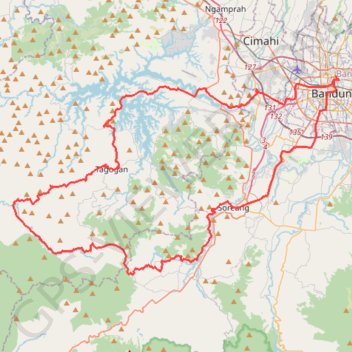
Bandung graventure
- Distance: 79.5 mi
- Elevation gain: 6,900 ft
- Maximum elevation: 4,554 ft
- Elevation loss: 6,883 ft
- Minimum elevation: 2,093 ft
Interactive trail map
Trail profile
- Distance: 79.5 mi
- Elevation gain: 6,900 ft
- Maximum elevation: 4,554 ft
- Elevation loss: 6,883 ft
- Minimum elevation: 2,093 ft
About this trail
Name: Bandung graventure trail, distance, elevation, map, profile, GPS track
Coordinates: -7.08968 107.31241 -6.90703 107.61483