Thank you for supporting this site ❤️
Make a donation
Make a donation
Gear up for your next adventure:
As an Amazon Associate, this site earns from qualifying purchases at no extra cost to you.
Ridge Trail
Interactive trail map
Thank you for supporting this site ❤️
Make a donation
Make a donation
Gear up for your next adventure:
As an Amazon Associate, this site earns from qualifying purchases at no extra cost to you.
Trail profile
- Distance: 2.1 mi
- Elevation gain: 325 ft
- Maximum elevation: 574 ft
- Elevation loss: 308 ft
- Minimum elevation: 302 ft
- Moving time: 48 m 40 s
- Moving speed: 2.5 mph
- Maximum speed: 3.8 mph
- Total time: 52 m 35 s
- Global speed: 2.4 mph
Thank you for supporting this site ❤️
Make a donation
Make a donation
Gear up for your next adventure:
As an Amazon Associate, this site earns from qualifying purchases at no extra cost to you.
About this trail
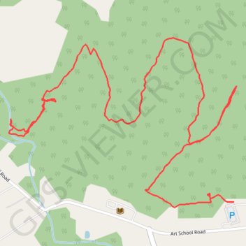
Name: Ridge Trail trail, distance, elevation, map, profile, GPS track
Coordinates: 40.10084 -75.62829 40.10616 -75.61895
Topography: West Pikeland Township topographic map, elevation, terrain
Thank you for supporting this site ❤️
Make a donation
Make a donation
Gear up for your next adventure:
As an Amazon Associate, this site earns from qualifying purchases at no extra cost to you.