Mastodon Peak
Interactive trail map
Trail profile
- Distance: 2.4 mi
- Elevation gain: 394 ft
- Maximum elevation: 3,363 ft
- Elevation loss: 384 ft
- Minimum elevation: 2,979 ft
About this trail
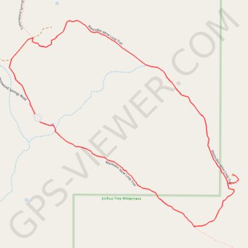
Name: Mastodon Peak trail, distance, elevation, map, profile, GPS track
Start: Mastodon Mine Loop Trail, Riverside County, California, United States (33.73680 -115.81062)
Coordinates: 33.73160 -115.81245 33.74183 -115.79880
Topography: Riverside County topographic map, elevation, terrain