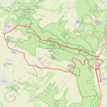
נווה אור - כוכב הירדן - נחל תבור
- Distance: 21.6 mi
- Elevation gain: 2,270 ft
- Maximum elevation: 955 ft
- Elevation loss: 2,267 ft
- Minimum elevation: -794 ft
Interactive trail map
Trail profile
- Distance: 21.6 mi
- Elevation gain: 2,270 ft
- Maximum elevation: 955 ft
- Elevation loss: 2,267 ft
- Minimum elevation: -794 ft
About this trail
Name: נווה אור - כוכב הירדן - נחל תבור trail, distance, elevation, map, profile, GPS track
Coordinates: 32.58594 35.44117 32.63952 35.55230