The Cumby Race Course
Interactive trail map
Trail profile
- Distance: 12.9 mi
- Elevation gain: 2,018 ft
- Maximum elevation: 1,378 ft
- Elevation loss: 2,005 ft
- Minimum elevation: 482 ft
About this trail
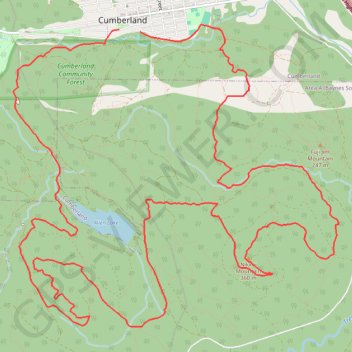
Name: The Cumby Race Course trail, distance, elevation, map, profile, GPS track
Coordinates: 49.58784 -125.04874 49.61802 -124.99883
Other hiking, mountain biking, running and outdoor activity trails
Click on a trail to view its statistics, map and profile.