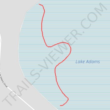
Lake Adams
- Distance: 0.8 mi
- Elevation gain: 20 ft
- Maximum elevation: 164 ft
- Elevation loss: 16 ft
- Minimum elevation: 151 ft
- Moving time: 13 m 53 s
- Moving speed: 3.3 mph
- Maximum speed: 6.6 mph
- Total time: 14 m 24 s
- Global speed: 3.2 mph
Interactive trail map
Trail profile
- Distance: 0.8 mi
- Elevation gain: 20 ft
- Maximum elevation: 164 ft
- Elevation loss: 16 ft
- Minimum elevation: 151 ft
- Moving time: 13 m 53 s
- Moving speed: 3.3 mph
- Maximum speed: 6.6 mph
- Total time: 14 m 24 s
- Global speed: 3.2 mph
About this trail
Name: Lake Adams trail, distance, elevation, map, profile, GPS track
Start: Neaves Road, Mariginiup, City of Wanneroo, Western Australia, 6078, Australia (-31.69736 115.81960)
Coordinates: -31.70501 115.81960 -31.69736 115.82241
Other hiking, mountain biking, running and outdoor activity trails
Click on a trail to view its statistics, map and profile.
2021 Toodyay return via Kep
Distance: 142.9 mi • Elevation gain: 6,099 ft • Maximum elevation: 1,171 ft