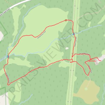
Serpentine Loop Trail
- Distance: 2.3 mi
- Elevation gain: 276 ft
- Maximum elevation: 699 ft
- Elevation loss: 279 ft
- Minimum elevation: 509 ft
- Moving time: 1 h 10 m
- Moving speed: 1.9 mph
- Maximum speed: 3.4 mph
- Total time: 1 h 13 m
- Global speed: 1.9 mph
Interactive trail map
Trail profile
- Distance: 2.3 mi
- Elevation gain: 276 ft
- Maximum elevation: 699 ft
- Elevation loss: 279 ft
- Minimum elevation: 509 ft
- Moving time: 1 h 10 m
- Moving speed: 1.9 mph
- Maximum speed: 3.4 mph
- Total time: 1 h 13 m
- Global speed: 1.9 mph
About this trail
Name: Serpentine Loop Trail trail, distance, elevation, map, profile, GPS track
Start: Serpentine Trail, Baltimore County, Maryland, United States (39.41019 -76.83829)
Coordinates: 39.40775 -76.85094 39.41431 -76.83829
Topography: Baltimore County topographic map, elevation, terrain