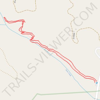
Toms Creek Falls Trail
- Distance: 1.0 mi
- Elevation gain: 259 ft
- Maximum elevation: 1,926 ft
- Elevation loss: 256 ft
- Minimum elevation: 1,667 ft
- Moving time: 30 m 32 s
- Moving speed: 2.0 mph
- Maximum speed: 4.3 mph
- Total time: 34 m 2 s
- Global speed: 1.8 mph
Interactive trail map
Trail profile
- Distance: 1.0 mi
- Elevation gain: 259 ft
- Maximum elevation: 1,926 ft
- Elevation loss: 256 ft
- Minimum elevation: 1,667 ft
- Moving time: 30 m 32 s
- Moving speed: 2.0 mph
- Maximum speed: 4.3 mph
- Total time: 34 m 2 s
- Global speed: 1.8 mph
About this trail
Name: Toms Creek Falls Trail trail, distance, elevation, map, profile, GPS track
Coordinates: 35.77465 -82.06277 35.77805 -82.05681
Topography: McDowell County topographic map, elevation, terrain