Blackmoorfoot reservoir and Crosland Moor
- Distance: 3.2 mi
- Elevation gain: 262 ft
- Maximum elevation: 896 ft
- Elevation loss: 262 ft
- Minimum elevation: 705 ft
- Moving time: 1 h 42 m
- Moving speed: 1.9 mph
- Maximum speed: 3.1 mph
- Total time: 1 h 54 m
- Global speed: 1.7 mph
Interactive trail map
Trail profile
- Distance: 3.2 mi
- Elevation gain: 262 ft
- Maximum elevation: 896 ft
- Elevation loss: 262 ft
- Minimum elevation: 705 ft
- Moving time: 1 h 42 m
- Moving speed: 1.9 mph
- Maximum speed: 3.1 mph
- Total time: 1 h 54 m
- Global speed: 1.7 mph
About this trail
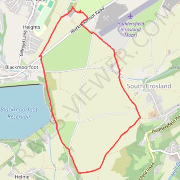
Name: Blackmoorfoot reservoir and Crosland Moor trail, distance, elevation, map, profile, GPS track
Coordinates: 53.60396 -1.84859 53.62175 -1.83045
Other hiking, mountain biking, running and outdoor activity trails
Click on a trail to view its statistics, map and profile.
Blackmoorfoot and South Crosland loop
United Kingdom > England > Kirklees > Meltham > Linthwaite > Helme
Distance: 3.1 mi • Elevation gain: 236 ft • Maximum elevation: 886 ft
Crosland Heath
United Kingdom > England > Kirklees > Linthwaite > Blackmoorfoot
Distance: 1.4 mi • Elevation gain: 151 ft • Maximum elevation: 896 ft