Import a GPX file

Bourgeau Lake

Banff National Park. #Hiking #Bourgeau #Banff

  • Distance: 9.1 mi
  • Elevation gain: 2,575 ft
  • Maximum elevation: 7,001 ft
  • Elevation loss: 2,579 ft
  • Minimum elevation: 4,659 ft

Interactive trail map

Trail profile

  • Distance: 9.1 mi
  • Elevation gain: 2,575 ft
  • Maximum elevation: 7,001 ft
  • Elevation loss: 2,579 ft
  • Minimum elevation: 4,659 ft

About this trail
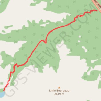
Name: Bourgeau Lake trail, distance, elevation, map, profile, GPS track

Start: Harvey Pass Trail Parking, Harvey Pass Tr, Improvement District No. 9, Alberta, Canada (51.16796 -115.73150)

End: Harvey Pass Tr, Improvement District No. 9, Alberta, Canada (51.16814 -115.73163)

Coordinates: 51.13712 -115.78899 51.16839 -115.73150

Gear up for your next adventure:

🥩Freeze-Dried Meals - Nutritious and lightweight food for remote expeditions
🧦Hiking Socks - Comfortable socks to prevent blisters on long hikes
📚USA Hiking Guide Books - Top trail guides and map books
🧥Waterproof Jacket for Hiking - Breathable and rugged rain jacket for outdoor excursions
🛌Ultralight Sleeping Bags - Compact down bags for cold nights in the wilderness

As an Amazon Associate, this site earns from qualifying purchases at no extra cost to you.