Gypsum Ridge
Peter Lougheed Provincial Park. #Hiking #Snowshoeing #PeterLougheed
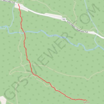
- Distance: 3.1 mi
- Elevation gain: 1,506 ft
- Maximum elevation: 6,818 ft
- Elevation loss: 1,506 ft
- Minimum elevation: 5,587 ft
Interactive trail map
Trail profile
- Distance: 3.1 mi
- Elevation gain: 1,506 ft
- Maximum elevation: 6,818 ft
- Elevation loss: 1,506 ft
- Minimum elevation: 5,587 ft
About this trail
Name: Gypsum Ridge trail, distance, elevation, map, profile, GPS track
Coordinates: 50.68191 -115.17340 50.69688 -115.15685