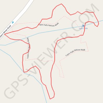
Lupin Falls Nature Walk
Buttle Lake. Strathcona Provincial Park. Vancouver Island. #Hiking #Loop #Buttle #Strathcona #Vancouver
- Distance: 0.5 mi
- Elevation gain: 194 ft
- Maximum elevation: 981 ft
- Elevation loss: 194 ft
- Minimum elevation: 804 ft
Interactive trail map
Trail profile
- Distance: 0.5 mi
- Elevation gain: 194 ft
- Maximum elevation: 981 ft
- Elevation loss: 194 ft
- Minimum elevation: 804 ft
About this trail
Name: Lupin Falls Nature Walk trail, distance, elevation, map, profile, GPS track
Coordinates: 49.79731 -125.59811 49.79919 -125.59523