Thank you for supporting this site ❤️
Make a donation
Make a donation
Gear up for your next adventure:
As an Amazon Associate, this site earns from qualifying purchases at no extra cost to you.
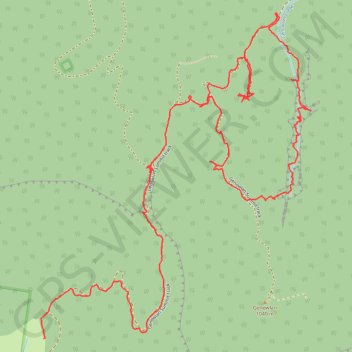
Valley of the Dinosaurs Capertee
Capertee Walking
- Distance: 3.5 mi
- Elevation gain: 663 ft
- Maximum elevation: 3,238 ft
- Elevation loss: 1,430 ft
- Minimum elevation: 2,260 ft
- Moving time: 1 h 29 m
- Moving speed: 2.3 mph
- Maximum speed: 12.1 mph
- Total time: 2 h 48 m
- Global speed: 1.2 mph
Interactive trail map
Thank you for supporting this site ❤️
Make a donation
Make a donation
Gear up for your next adventure:
As an Amazon Associate, this site earns from qualifying purchases at no extra cost to you.
Trail profile
- Distance: 3.5 mi
- Elevation gain: 663 ft
- Maximum elevation: 3,238 ft
- Elevation loss: 1,430 ft
- Minimum elevation: 2,260 ft
- Moving time: 1 h 29 m
- Moving speed: 2.3 mph
- Maximum speed: 12.1 mph
- Total time: 2 h 48 m
- Global speed: 1.2 mph
Thank you for supporting this site ❤️
Make a donation
Make a donation
Gear up for your next adventure:
As an Amazon Associate, this site earns from qualifying purchases at no extra cost to you.
About this trail
Name: Valley of the Dinosaurs Capertee trail, distance, elevation, map, profile, GPS track
Coordinates: -33.12069 150.04676 -33.10929 150.05805
Thank you for supporting this site ❤️
Make a donation
Make a donation
Gear up for your next adventure:
As an Amazon Associate, this site earns from qualifying purchases at no extra cost to you.