Thank you for supporting this site ❤️
Make a donation
Make a donation
Gear up for your next adventure:
As an Amazon Associate, this site earns from qualifying purchases at no extra cost to you.
Erbhaven Trails
- Distance: 0.8 mi
- Elevation gain: 26 ft
- Maximum elevation: 1,207 ft
- Elevation loss: 33 ft
- Minimum elevation: 1,181 ft
- Moving time: 24 m 28 s
- Moving speed: 2.1 mph
- Maximum speed: 4.0 mph
- Total time: 46 m 46 s
- Global speed: 1.1 mph
Interactive trail map
Thank you for supporting this site ❤️
Make a donation
Make a donation
Gear up for your next adventure:
As an Amazon Associate, this site earns from qualifying purchases at no extra cost to you.
Trail profile
- Distance: 0.8 mi
- Elevation gain: 26 ft
- Maximum elevation: 1,207 ft
- Elevation loss: 33 ft
- Minimum elevation: 1,181 ft
- Moving time: 24 m 28 s
- Moving speed: 2.1 mph
- Maximum speed: 4.0 mph
- Total time: 46 m 46 s
- Global speed: 1.1 mph
Thank you for supporting this site ❤️
Make a donation
Make a donation
Gear up for your next adventure:
As an Amazon Associate, this site earns from qualifying purchases at no extra cost to you.
About this trail
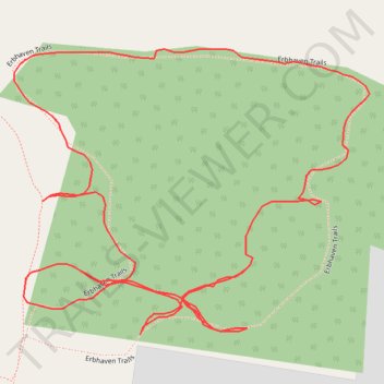
Name: Erbhaven Trails trail, distance, elevation, map, profile, GPS track
Coordinates: 43.47957 -80.77502 43.48135 -80.77197
Thank you for supporting this site ❤️
Make a donation
Make a donation
Gear up for your next adventure:
As an Amazon Associate, this site earns from qualifying purchases at no extra cost to you.