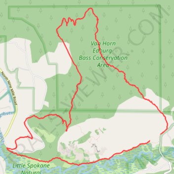
Knothead Valley Loop, clockwise
- Distance: 6.8 mi
- Elevation gain: 1,115 ft
- Maximum elevation: 2,441 ft
- Elevation loss: 1,086 ft
- Minimum elevation: 1,549 ft
Interactive trail map
Trail profile
- Distance: 6.8 mi
- Elevation gain: 1,115 ft
- Maximum elevation: 2,441 ft
- Elevation loss: 1,086 ft
- Minimum elevation: 1,549 ft
About this trail
Name: Knothead Valley Loop, clockwise trail, distance, elevation, map, profile, GPS track
Start: Painted Rocks Nature Trail, Spokane County, Washington, 99026, United States (47.78269 -117.49859)
End: Knothead Trail, Spokane County, Washington, 99026, United States (47.78368 -117.49627)
Coordinates: 47.77916 -117.52928 47.80177 -117.49482
Topography: Spokane County topographic map, elevation, terrain