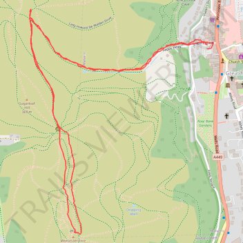
Malvern Hills Walk to Worcestershire Beacon
- Distance: 2.5 mi
- Elevation gain: 869 ft
- Maximum elevation: 1,385 ft
- Elevation loss: 873 ft
- Minimum elevation: 509 ft
- Moving time: 1 h 22 m
- Moving speed: 1.8 mph
- Maximum speed: 6.9 mph
- Total time: 1 h 42 m
- Global speed: 1.4 mph
Interactive trail map
Trail profile
- Distance: 2.5 mi
- Elevation gain: 869 ft
- Maximum elevation: 1,385 ft
- Elevation loss: 873 ft
- Minimum elevation: 509 ft
- Moving time: 1 h 22 m
- Moving speed: 1.8 mph
- Maximum speed: 6.9 mph
- Total time: 1 h 42 m
- Global speed: 1.4 mph
About this trail
Name: Malvern Hills Walk to Worcestershire Beacon trail, distance, elevation, map, profile, GPS track
Coordinates: 52.10494 -2.34159 52.11337 -2.33040