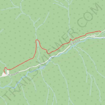
Peter Roulston Trail
- Distance: 3.6 mi
- Elevation gain: 453 ft
- Maximum elevation: 2,730 ft
- Elevation loss: 302 ft
- Minimum elevation: 2,513 ft
- Moving time: 1 h 20 m
- Moving speed: 2.7 mph
- Maximum speed: 4.2 mph
- Total time: 1 h 44 m
- Global speed: 2.1 mph
Interactive trail map
Trail profile
- Distance: 3.6 mi
- Elevation gain: 453 ft
- Maximum elevation: 2,730 ft
- Elevation loss: 302 ft
- Minimum elevation: 2,513 ft
- Moving time: 1 h 20 m
- Moving speed: 2.7 mph
- Maximum speed: 4.2 mph
- Total time: 1 h 44 m
- Global speed: 2.1 mph
About this trail
Name: Peter Roulston Trail trail, distance, elevation, map, profile, GPS track
Coordinates: 50.28213 -117.75066 50.29768 -117.69555
Other hiking, mountain biking, running and outdoor activity trails
Click on a trail to view its statistics, map and profile.