Mount Kalhatti
#Bike
- Distance: 11.5 mi
- Elevation gain: 4,721 ft
- Maximum elevation: 7,178 ft
- Elevation loss: 614 ft
- Minimum elevation: 2,920 ft
Interactive trail map
Trail profile
- Distance: 11.5 mi
- Elevation gain: 4,721 ft
- Maximum elevation: 7,178 ft
- Elevation loss: 614 ft
- Minimum elevation: 2,920 ft
About this trail
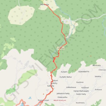
Name: Mount Kalhatti trail, distance, elevation, map, profile, GPS track
End: Gudallur-Ooty Road, Pykara, Udhagamandalam, Nilgiris, Tamil Nadu, India (11.44538 76.66942)
Coordinates: 11.44538 76.66942 11.54833 76.69883