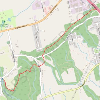
Borer's Falls
- Distance: 4.1 mi
- Elevation gain: 581 ft
- Maximum elevation: 686 ft
- Elevation loss: 581 ft
- Minimum elevation: 509 ft
Interactive trail map
Trail profile
About this trail
Name: Borer's Falls trail, distance, elevation, map, profile, GPS track
Start: 390, Old Guelph Road, Hamilton, Golden Horseshoe, Ontario, L9H 0C5, Canada (43.30744 -79.91156)
End: 390, Old Guelph Road, Hamilton, Golden Horseshoe, Ontario, L9H 0C5, Canada (43.30744 -79.91156)
Coordinates: 43.29152 -79.93641 43.30752 -79.91156
Other hiking, mountain biking, running and outdoor activity trails
Click on a trail to view its statistics, map and profile.
Aldershot - Kitchener
Canada > Ontario > Halton Region > Burlington
#Bike
Distance: 49.1 mi • Elevation gain: 1,870 ft • Maximum elevation: 1,135 ft