
Hillwalk expedition via Seana Bhràigh, Eididh nan Clach Geala, Meall nan Ceapraichean, Cona' Mheall and Beinn Dearg
- Distance: 24.3 mi
- Elevation gain: 6,506 ft
- Maximum elevation: 3,550 ft
- Elevation loss: 6,568 ft
- Minimum elevation: 33 ft
- Moving time: 10 h 46 m
- Moving speed: 2.3 mph
- Maximum speed: 4.9 mph
- Total time: 1 d 2 h
- Global speed: 0.9 mph
Interactive trail map
Trail profile
- Distance: 24.3 mi
- Elevation gain: 6,506 ft
- Maximum elevation: 3,550 ft
- Elevation loss: 6,568 ft
- Minimum elevation: 33 ft
- Moving time: 10 h 46 m
- Moving speed: 2.3 mph
- Maximum speed: 4.9 mph
- Total time: 1 d 2 h
- Global speed: 0.9 mph
About this trail
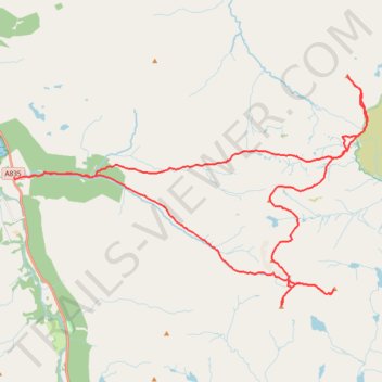
Name: Hillwalk expedition via Seana Bhràigh, Eididh nan Clach Geala, Meall nan Ceapraichean, Cona' Mheall and Beinn Dearg trail, distance, elevation, map, profile, GPS track
Start: A835, Inverlael, Highland, Scotland, IV23 2RG, United Kingdom (57.82054 -5.05515)
End: Inverlael, A835, Inverlael, Highland, Scotland, IV23 2RG, United Kingdom (57.82050 -5.06241)
Coordinates: 57.78635 -5.06241 57.84733 -4.88674