Import a GPX file

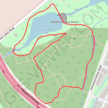
Colliery Dam Park Loop

Vancouver Island. #Hiking #Running #Loop #Vancouver

  • Distance: 1.4 mi
  • Elevation gain: 177 ft
  • Maximum elevation: 433 ft
  • Elevation loss: 177 ft
  • Minimum elevation: 299 ft

Interactive trail map

Trail profile

  • Distance: 1.4 mi
  • Elevation gain: 177 ft
  • Maximum elevation: 433 ft
  • Elevation loss: 177 ft
  • Minimum elevation: 299 ft

About this trail
Gear up for your next adventure:

🚑Emergency Bivvies - Heat-reflective sleeping bags for survival situations
📚Navigation Handbooks - Master the art of reading topographic maps and using a compass
🧢Sun Protection Hats - Wide-brimmed and UPF-rated hats for high-altitude sun safety
🦶Hiking Gaiters - Keep debris and water out of your boots
⌚Solar GPS Watches - Advanced multisport watches with built-in topographic maps

As an Amazon Associate, this site earns from qualifying purchases at no extra cost to you.