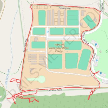
Hansen Dam near Orcas park
- Distance: 1.9 mi
- Elevation gain: 95 ft
- Maximum elevation: 1,086 ft
- Elevation loss: 95 ft
- Minimum elevation: 1,017 ft
- Moving time: 36 m 52 s
- Moving speed: 3.1 mph
- Maximum speed: 5.2 mph
- Total time: 38 m 30 s
- Global speed: 3.0 mph
Interactive trail map
Trail profile
- Distance: 1.9 mi
- Elevation gain: 95 ft
- Maximum elevation: 1,086 ft
- Elevation loss: 95 ft
- Minimum elevation: 1,017 ft
- Moving time: 36 m 52 s
- Moving speed: 3.1 mph
- Maximum speed: 5.2 mph
- Total time: 38 m 30 s
- Global speed: 3.0 mph
About this trail
Name: Hansen Dam near Orcas park trail, distance, elevation, map, profile, GPS track
Coordinates: 34.26824 -118.37386 34.27310 -118.36835
Topography: Los Angeles topographic map, elevation, terrain
Other hiking, mountain biking, running and outdoor activity trails
Click on a trail to view its statistics, map and profile.
Hansen Dam Little Tujunga Area
United States > California > Los Angeles County > Los Angeles
Distance: 1.9 mi • Elevation gain: 75 ft • Maximum elevation: 1,060 ft