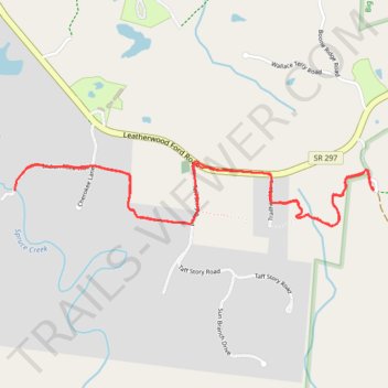
Spruce Creek Trail
- Distance: 3.8 mi
- Elevation gain: 338 ft
- Maximum elevation: 1,578 ft
- Elevation loss: 338 ft
- Minimum elevation: 1,453 ft
Interactive trail map
Trail profile
- Distance: 3.8 mi
- Elevation gain: 338 ft
- Maximum elevation: 1,578 ft
- Elevation loss: 338 ft
- Minimum elevation: 1,453 ft
About this trail
Name: Spruce Creek Trail trail, distance, elevation, map, profile, GPS track
Start: Fentress County, Middle Tennessee, Tennessee, United States (36.47263 -84.75151)
Coordinates: 36.47067 -84.77175 36.47362 -84.75136
Topography: Fentress County topographic map, elevation, terrain
Other hiking, mountain biking, running and outdoor activity trails
Click on a trail to view its statistics, map and profile.
Cumberland Valley Loop Trail
United States > Tennessee > Fentress County
Fentress County Dia
Distance: 18.2 mi • Elevation gain: 1,683 ft • Maximum elevation: 1,591 ft