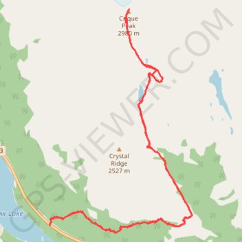
Bow Lake - Helen Lake - Cirque Peak
Interactive trail map
Trail profile
- Distance: 11.0 mi
- Elevation gain: 3,635 ft
- Maximum elevation: 9,741 ft
- Elevation loss: 3,589 ft
- Minimum elevation: 6,437 ft
About this trail
Name: Bow Lake - Helen Lake - Cirque Peak trail, distance, elevation, map, profile, GPS track
Start: Icefields Parkway, Improvement District No. 9, Alberta, Canada (51.66302 -116.43850)
End: Helen Lake Trail, Improvement District No. 9, Alberta, Canada (51.66411 -116.43848)
Coordinates: 51.66174 -116.43851 51.70013 -116.39927
Other hiking, mountain biking, running and outdoor activity trails
Click on a trail to view its statistics, map and profile.