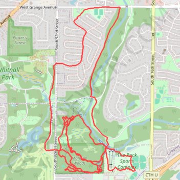
Trails near Root River
Afternoon Run
- Distance: 10.1 mi
- Elevation gain: 653 ft
- Maximum elevation: 873 ft
- Elevation loss: 653 ft
- Minimum elevation: 699 ft
- Moving time: 1 h 54 m
- Moving speed: 5.3 mph
- Maximum speed: 9.0 mph
- Total time: 1 h 54 m
- Global speed: 5.3 mph
Interactive trail map
Trail profile
- Distance: 10.1 mi
- Elevation gain: 653 ft
- Maximum elevation: 873 ft
- Elevation loss: 653 ft
- Minimum elevation: 699 ft
- Moving time: 1 h 54 m
- Moving speed: 5.3 mph
- Maximum speed: 9.0 mph
- Total time: 1 h 54 m
- Global speed: 5.3 mph
About this trail
Name: Trails near Root River trail, distance, elevation, map, profile, GPS track
Coordinates: 42.91981 -88.03081 42.94480 -88.01230
Topography: Milwaukee County topographic map, elevation, terrain