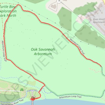
Arboretum Loop Trail
Walking
- Distance: 1.2 mi
- Elevation gain: 43 ft
- Maximum elevation: 554 ft
- Elevation loss: 85 ft
- Minimum elevation: 486 ft
- Moving time: 29 m 2 s
- Moving speed: 2.4 mph
- Maximum speed: 3.2 mph
- Total time: 47 m 2 s
- Global speed: 1.5 mph
Interactive trail map
Trail profile
- Distance: 1.2 mi
- Elevation gain: 43 ft
- Maximum elevation: 554 ft
- Elevation loss: 85 ft
- Minimum elevation: 486 ft
- Moving time: 29 m 2 s
- Moving speed: 2.4 mph
- Maximum speed: 3.2 mph
- Total time: 47 m 2 s
- Global speed: 1.5 mph
About this trail
Name: Arboretum Loop Trail trail, distance, elevation, map, profile, GPS track
Start: Aboretum Loop Trail, Redding, Shasta County, California, 96003, United States (40.59516 -122.37162)
Coordinates: 40.59294 -122.38002 40.59924 -122.37162
Topography: Redding topographic map, elevation, terrain